Object
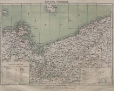
Title: Provinz Pommern
Description:
Publisher:
Lith. Druck u. Verlag von C. Flemming in Glogau
Publication Place:
Language:
Format:
Resource Identifier:
oai:zbc.ksiaznica.szczecin.pl:2150
Source:
Relation:
online catalogue:
Rights Management:
Original Localization:

Object collections:
- Digital Library > 1. POMERANICA > Cartographical documents
- Digital Library > 2. CULTURAL HERITAGE > Cartographical documents
Last modified:
Mar 24, 2011
In our library since:
Jun 5, 2009
Number of object content hits:
247
Number of object content views in DjVu format
227
All available object's versions:
https://zbc.ksiaznica.szczecin.pl/publication/2515
Show description in RDF format:
Show description in OAI-PMH format:
| Edition name | Date |
|---|---|
| Provinz Pommern | Mar 24, 2011 |